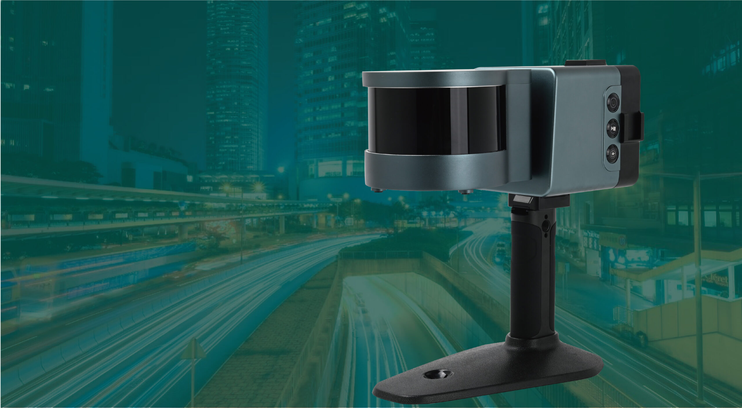
Cygnus: A new 3D mobile scanner for your efficiency
CLICK HERE TO DOWNLOAD THIS CASE STUDY
Background: The growing need for 3D modelling
The METAVERSE described by Neal Stephenson in the Snow Crash has gradually become known. And this virtual reality world is getting closer and closer to us due to the rapid development of other technologies such as VR, AR, MR, etc. At the same time, the real scenes of projection in the digital world like digital twins and smart cities are becoming the direction of development in urban governance and information technology construction. Not only the demands in 3D modelling of cities are growing, but the need for highly refined management of urban elements and components is also increasing. For instance, buildings, highways, blocks, utility components and other types of above and below-ground spaces are being digitally modelled for collection, display, and use through 3D platforms.
The requirements for spatial data are also rapidly iterating from the previous 2D to 3D in different industries. The 2D spatial data fails to meet today’s management and use requirements, while the high-precision 3D data can provide very accurate vertical spatial information for volume estimation and cost estimation. Moreover, the 3D data can also be used as a database for advanced analyses in daylighting, penetration, and inundation.
LiDAR technology empowers 3D modeling
The efficiency of data collection is very difficult to control during 3D modelling. Using RTK or total stations is the traditional way for data acquisition and is acceptable to service providers or users. However, these traditional data-collecting methods are becoming costly since labour rates are increasing.
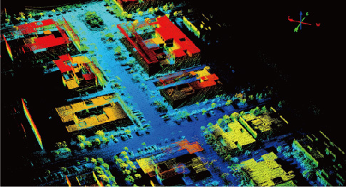
As a result, LiDAR technology came into being. By combining with GNSS technology to provide high-density point cloud data for modelling purposes, the airborne LiDAR systems, vehicle-mounted mobile mapping systems and terrestrial LiDAR scanners significantly improve the efficiency of data collection.
The airborne LIDAR technology uses UAV to carry the LiDAR scanner to quickly scan large areas of the ground from the air, and the vehicle-mounted mobile mapping systems can target both sides of the road on the ground for rapid data acquisition, while the terrestrial LiDAR scanners can scan in any required environment, making airborne and vehicle-mounted systems complete. The development of LiDAR technology has greatly improved the efficiency of high-precision spatial data acquisition and made 3D modelling no longer a headache.
However, it is well known that the price and usage cost of all three systems are usually very high, and users must balance the options carefully to obtain satisfactory data results. In addition, the pre-use preparations of using these three pieces of equipment are complex, which can be very problematic if rework.
So how do you solve the new problem?
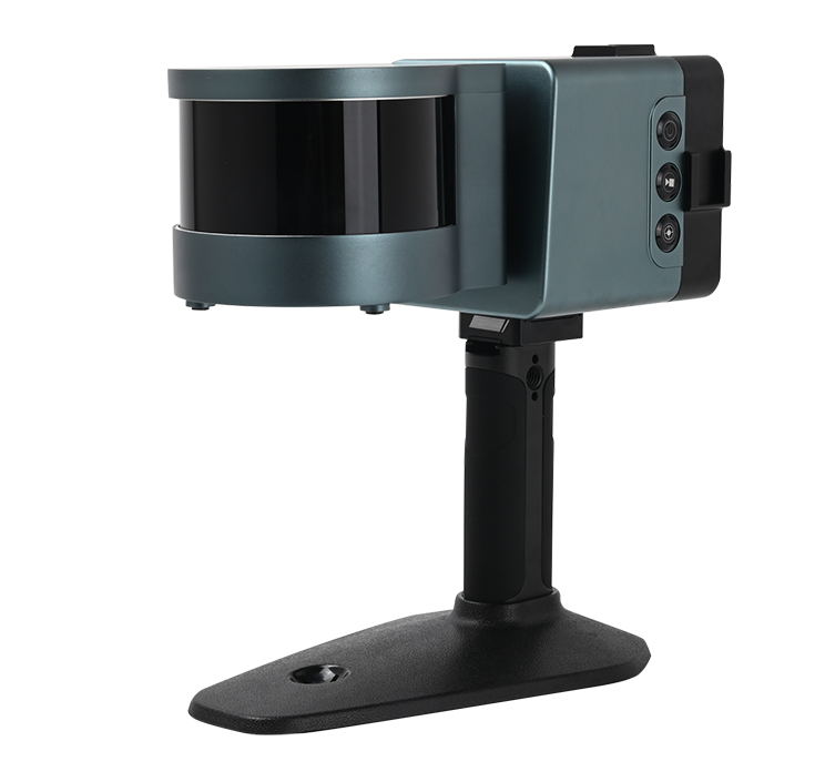
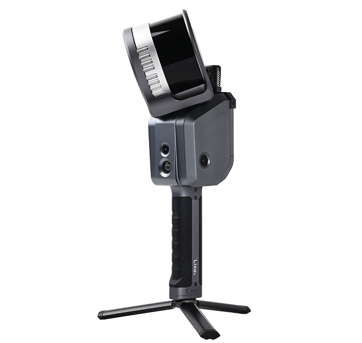
Cygnus: A new 3D mobile scanner for your efficiency
Now, the SatLab Cygnus Handheld SLAM scanner brings a whole new experience.
Combining the latest SLAM (Simultaneous Localization And Mapping) technology with the most efficient and revolutionary algorithms, the Cygnus will support and assist you in improving 3D point cloud data acquisition efficiency to the fullest. Even without GNSS satellites, Cygnus can still help to acquire data easily, efficiently, quickly, and flexibly in any outdoor, indoor, underground, or other heavily obscured location.
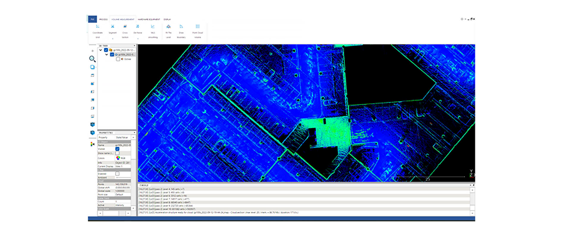
The powerful SatLab SLAM Manager APP provides fast real-time data processing and data preview, and the post-processing software SLAM Studio will support a wide range of data post-processing functions to ensure your work in one step.
The design of Cygnus makes it compatible with multi-platforms, such as drones, vehicles, or even backpacks.
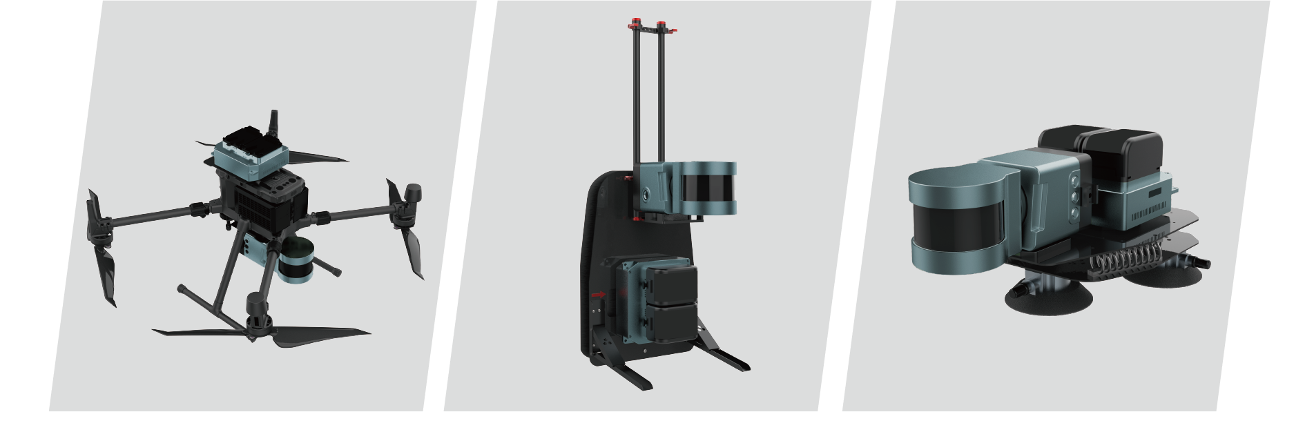
Cygnus can both provide color point cloud data and georeferenced point cloud data when required. And with optional components, for example, color data modules and GNSS systems, you can quickly obtain all the data features you need at the same time for subsequent applications.
Applications
The Cygnus can be used for mining, forestry, underground digitisation, construction and other scenarios or work environments that require 3D modelling.
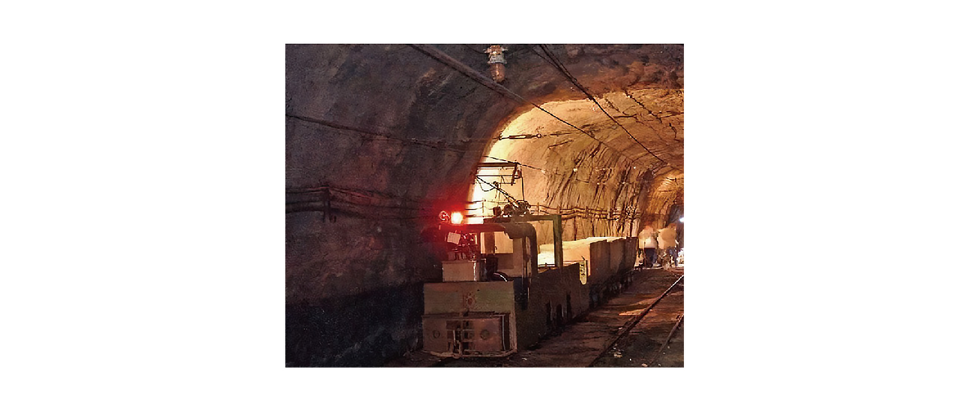
1. Mining
Digitization in the mining industry is now becoming very critical. In some cases, mine tunnels need to be measured and mapped to produce 3D maps to correlate with the other extremely complex tunnels.
Using Cygnus, the user can capture 3D maps in such narrow and irregular environments efficiently. Moreover, these 3D maps also enable the owner to analyze the underground resources and the volume of material, which are crucial for future planning.
Additionally, volume calculation of the stockpile can also be done by Cygnus. By comparing two successive scans of the point cloud, it is easy to calculate the increase or decrease in material, as well as for more accurate cost estimates.
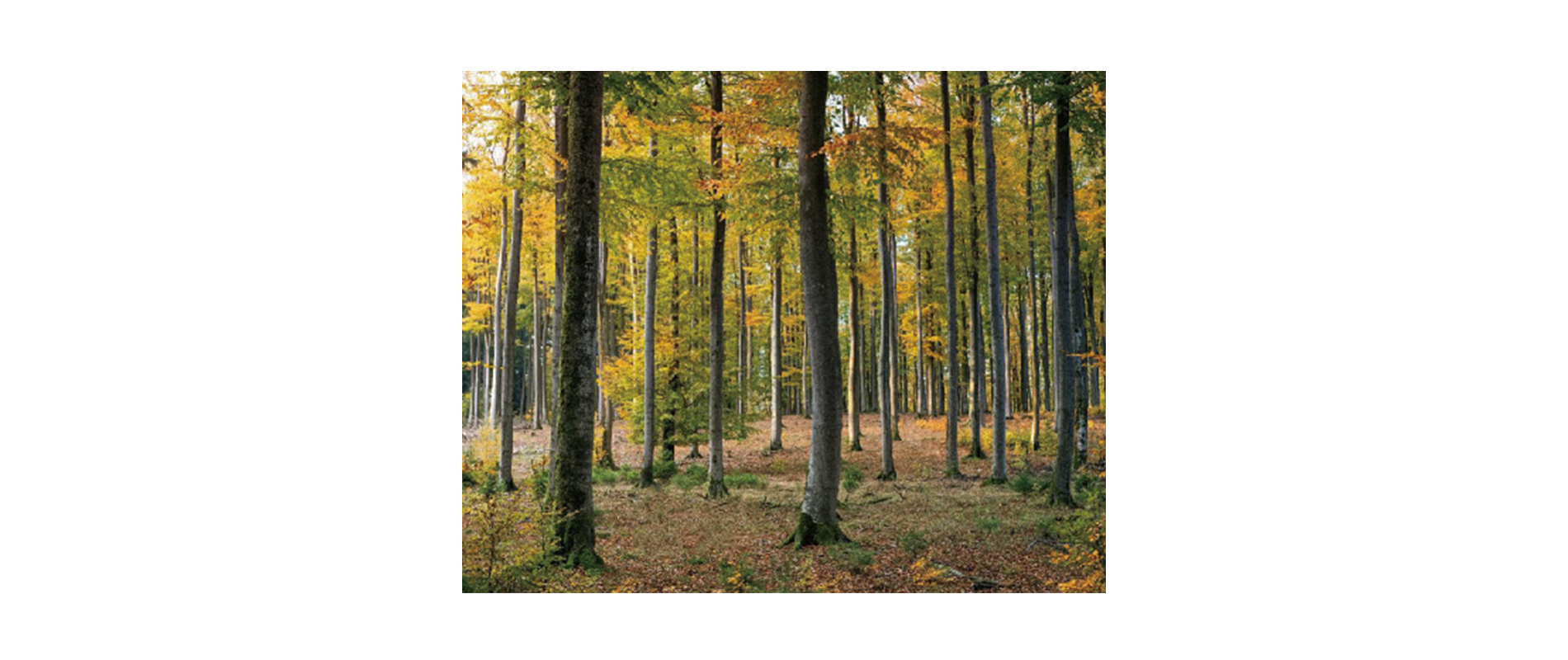
2. Forestry and natural resources
In forestry management, the management of vegetation cover and quantity is the priority. After applying Cygnus in the management, the working efficiency will increase by over 50%.
The Cygnus can acquire point cloud data for ground extraction, tree location detection, radius analysis, and crown volume measurement quickly without spending too much time travelling through dense forests. Compared to the traditional tape and total station measurements, it is obvious that the SLAM technology revolutionizes the quality and efficiency of forestry management.
3. Construction, Engineering and Utility
Previous building surveys and services have been limited to 2D data, only making up the entire building with floor plans of different floors, which is far from sufficient. Details of stairwells can affect the whole design and realization, while modern, increasingly complex building designs can be painful.
But now, 3D data is leading a creative way for the new construction industry. Cygnus offers a fast, accurate and versatile method to the industry since the point cloud data and models acquired can provide a multitude of uses. This is what floor plan drawings, section and plan drawings cannot be compared with.
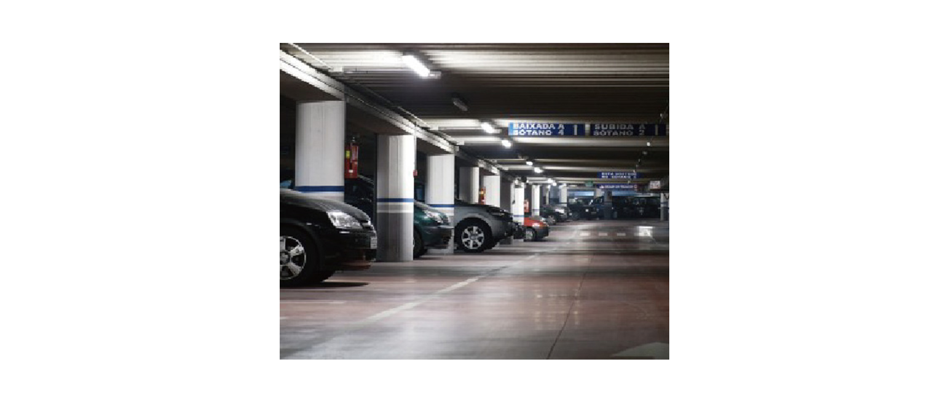
Besides buildings, Cygnus is also an ideal choice to acquire 3D data for those modern cities with complex above and below-ground facilities, like viaducts, overheads, subways, or underground car parks, which need to be repaired or rebuilt.
4. Other Industries
Not only the industries mentioned above, but varieties of other industries could also benefit from this technology.
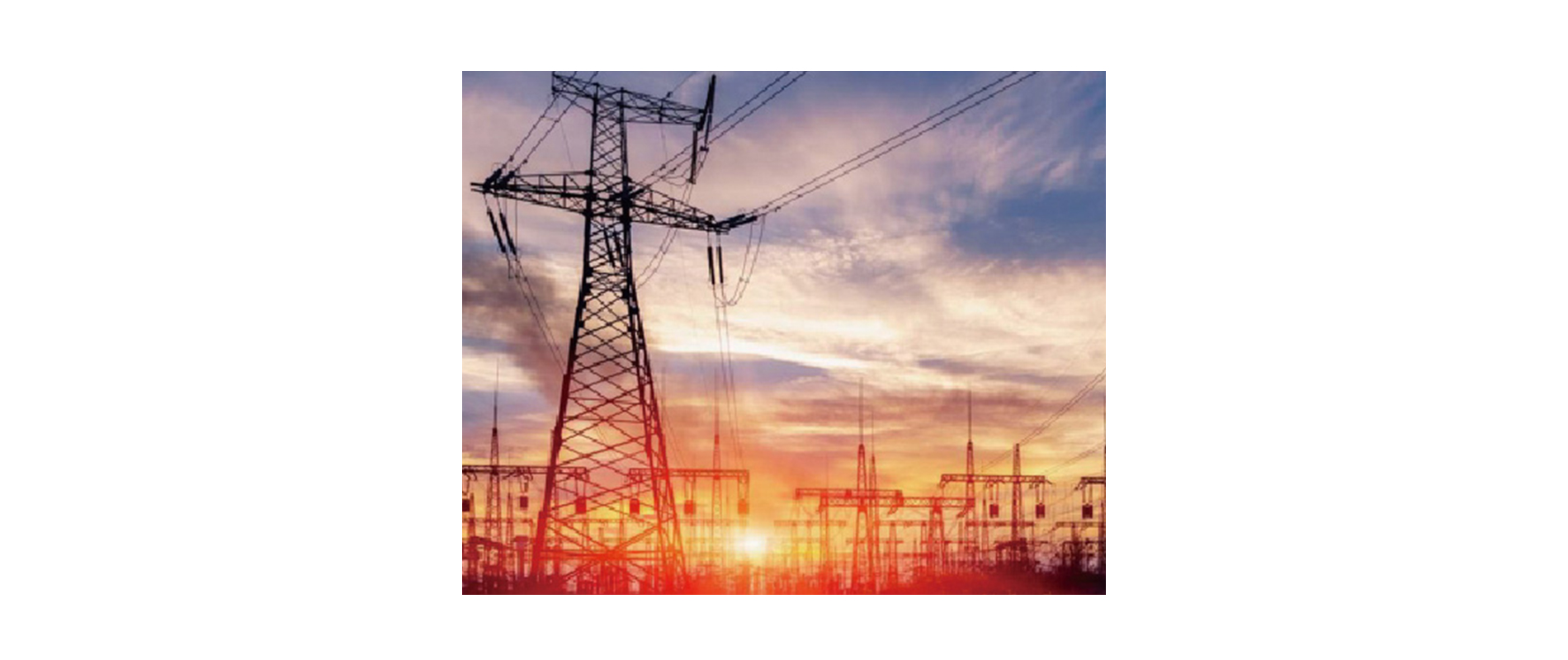
For geospatial users, working with Cygnus will be more efficient and faster than using GNSS and total stations for cadastral surveying and mapping. Moreover, Cygnus can also be used for some of the data collection work associated with heritage conservation. And for the power industry——probably the most mature industry currently using LiDAR for 3D model acquisition and management——Cygnus will work with the associated processes seamlessly.
Outlook
Cygnus is one of the most convenient, flexible, and cost-effective 3D laser scanning products that can significantly improve the efficiency of a wide range of work processes. This new technology option is gaining traction and will be combined with diverse industries and applications in the future.